Skip to main content
Search
Search This Blog
The Brown Knowser
Ottawa & Elsewhere. Photos & Fiction. Reviews & Rants. Musings & Utter Nonsense.
Posts
Showing posts from August, 2021
Show all
August 31, 2021
One More Paddle
August 30, 2021
Putter
August 27, 2021
Exhaustion
August 26, 2021
Out on the Bay
August 25, 2021
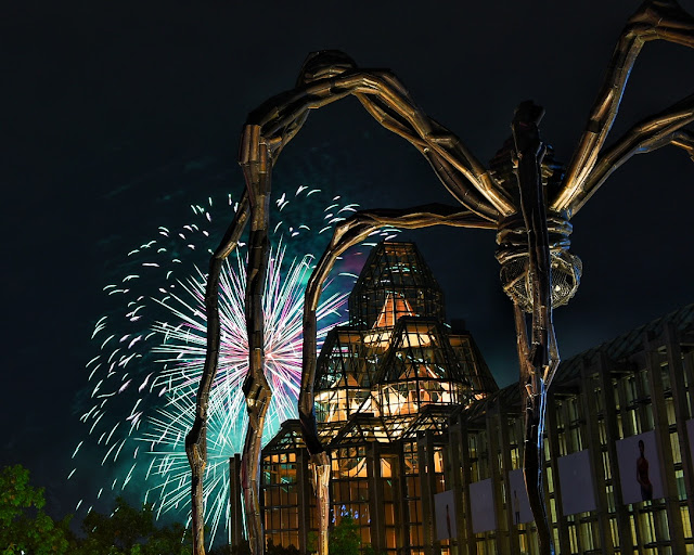
Fireworks for Maman & Over a Bridge
August 24, 2021
The Last Overnight Camp Trip
August 23, 2021
One Year Olds
August 20, 2021
Gimme Shelter
August 19, 2021
Sandwich Boards and Politics
August 18, 2021
Amongst the Sunflowers
August 17, 2021
Getting Naked
August 16, 2021
One of Those Weekends
Newer Posts
Older Posts
Home