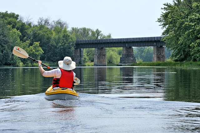
Up the Mississippi (and Back)
The last time that DW and I paddled the Mississippi River (not that one, the one in Ontario), we took our kayaks only a short way, following the current from Pakenham's Five Span Bridge toward Galetta. Feeling really ambitious, I was hoping that we'd make it all the way to Galetta and turn around before the dam forced us to stop, anyway.
Knowing that was going to be about 10 kilometres each way, I thought that we would aim for the Highway 417 overpass, which was about the halfway point, and see how we felt.
We didn't even make it to the Upper Dwyer Hill Road overpass, about a half-kilometre before Highway 417. Instead, we turned around about four-and-a-half kilometres downstream from Pakenham. Our total distance for that excursion was just over nine kilometres.
We promised ourselves that we'd be back again, wouldn't spend so much time stopping to photograph the birds and turtles, and quit frigging around with my 360-degree video camera.
Yesterday, we were back on the Mississippi.
This time, however, we decided that we would explore the river from the other side of the Five Span Bridge, working our way upstream to see how far we could go. And because we're planning another kayak-camping trip, this coming weekend, we wanted to get a good distance of paddling in.
Because of the falls and rapids at the Five Span Bridge, we couldn't put our kayaks in at the same point. This time, we drove into the village of Pakenham and parked at Fred Millar Field, just a bit upstream from the narrow, old bridge. A gravel put in was shallow and easy access for our kayaks.
Checking our map, we figured that we could paddle all the way to the bottom of Blakeney Rapids, just under 8 kms away. We packed our mini cooler bag, which held ice-cold cans of sparkling water and a can of cider for DW. We had stopped at a Tim Horton's and picked up sandwiches (and a donut for DW), which we also threw into the cooler, and stuffed into my aft storage compartment.
As with our first paddle on the Mississippi River, we remarked at how calm it was, and in spots the water was like glass, casting a perfect reflection. We stopped a couple of times to photograph the wildlife—mostly birds and turtles—but DW spied a deer that came right down to the river's edge, and we were both able to capture it with our cameras. I left my 360-degree camera at home, opting to mostly use my Nikon D7200, with a 70–300mm lens, and my smartphone.
For the most part, we made good time, covering a kilometre every 10 minutes. After about an hour and a half, we made it to the bottom of the rapids. We put our kayaks in at a rocky outcrop, grabbed our cooler, and made it to a ledge just above the last chute through the rapids, before the Mississippi emptied into a basin and became a wider river again.
After our snack, we powered almost non-stop back to Pakenham, averaging a kilometre in about nine minutes. It's about the fastest I'd ever want to paddle in my kayak, and I know that sometime today, if not already (by the time this post is published), my shoulders, arms, and back are going to feel the burn. With the kayaks secured to our Niro, I had the biggest craving for an ice-cold beer. With my Dry July challenge, however, another sparkling water had to do.DW and I will definitely be back to the Mississippi River and will paddle back to Blakeney Rapids. We'd also like to finish our first paddle, making it to Galetta and back. And who knows? Maybe, we'll even see what lies on the Mississippi River, upstream from Blakeney Rapids. Can we paddle to Almonte?
Stay tuned.


Comments
Post a Comment